

|
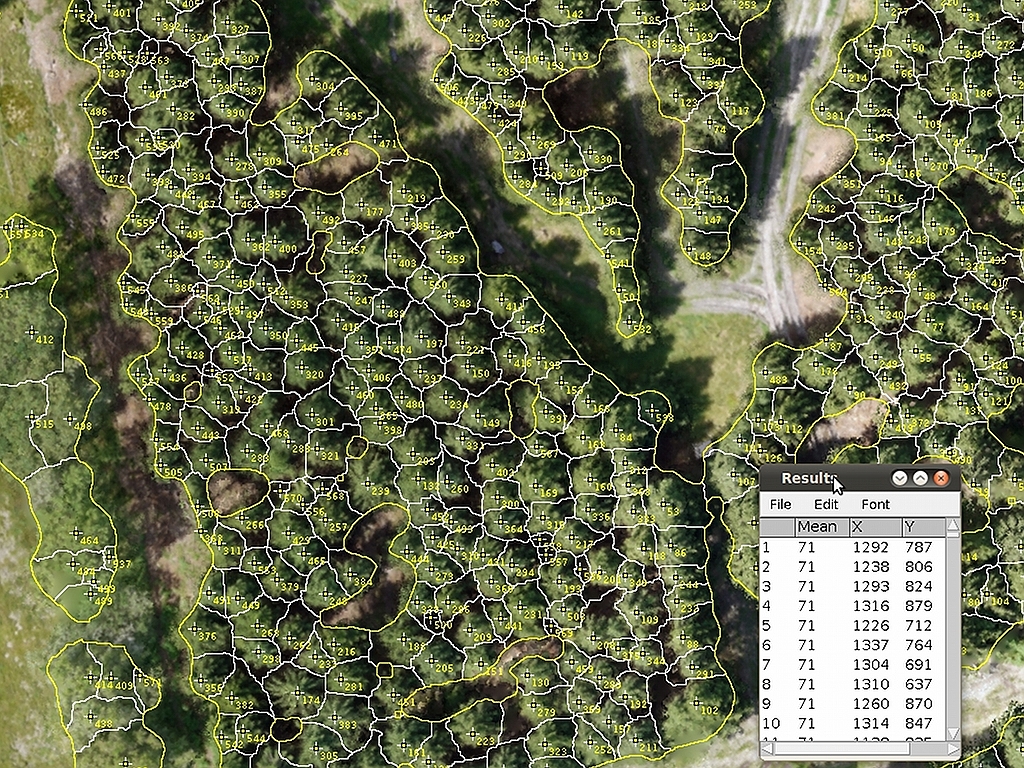
Automated tree counting and crown delineationWe use a fast and easy automated procedure to count individual trees and to delineate the area occupied by their canopy. In a first step the local height maxima are analyzed and the tree tops are determined. After that, spatial segmentation algorithms are performed to approximate the area covered by the crown. |
|
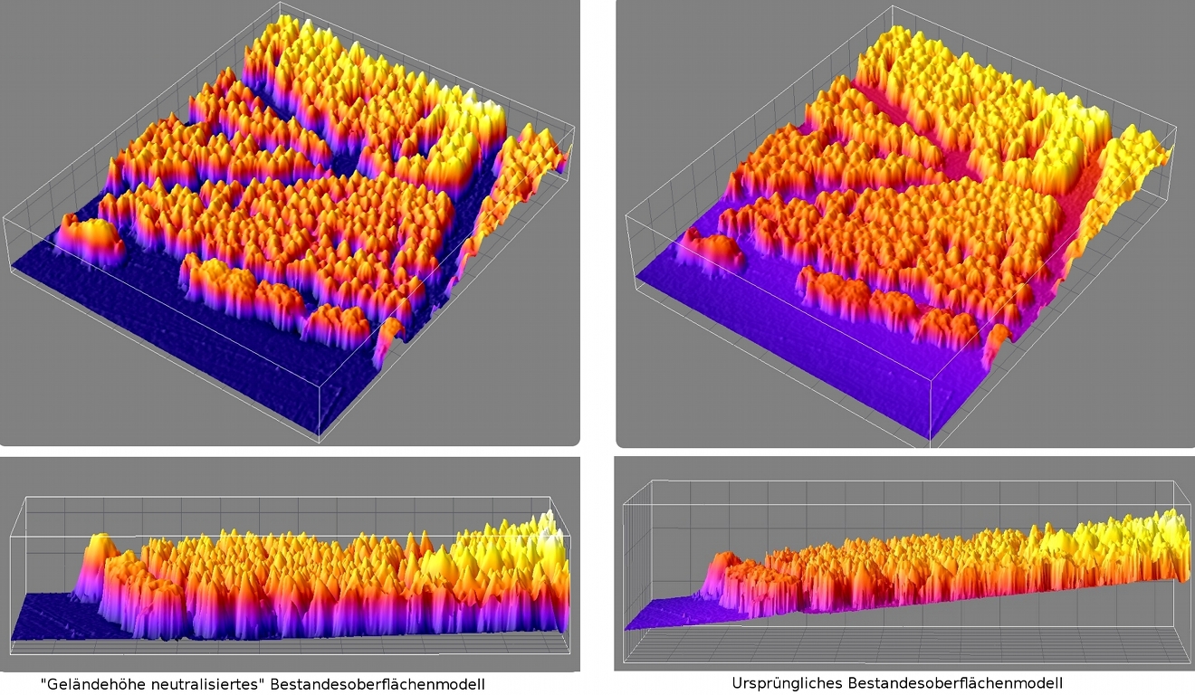
Forest stand wide tree height calculationDigital surface models that have been corrected for the contour of the terrain can be used to measure directly the height of individual trees detected within a forest.Alternatively tree height can be calculated from the cross-sectional profile for each tree identified. |
|
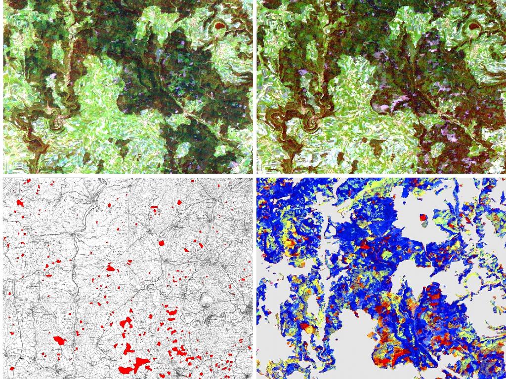
Damage mapping of natural or environmental hazardsWe perform large and small area damage mapping using aerial and satellite images, e. g. storm damage mapping for forested areas. |
Data analysis